Tamborine National Park
Tamborine National Park offers many opportunities for visitors to explore and enjoy the scenic natural surrounds.
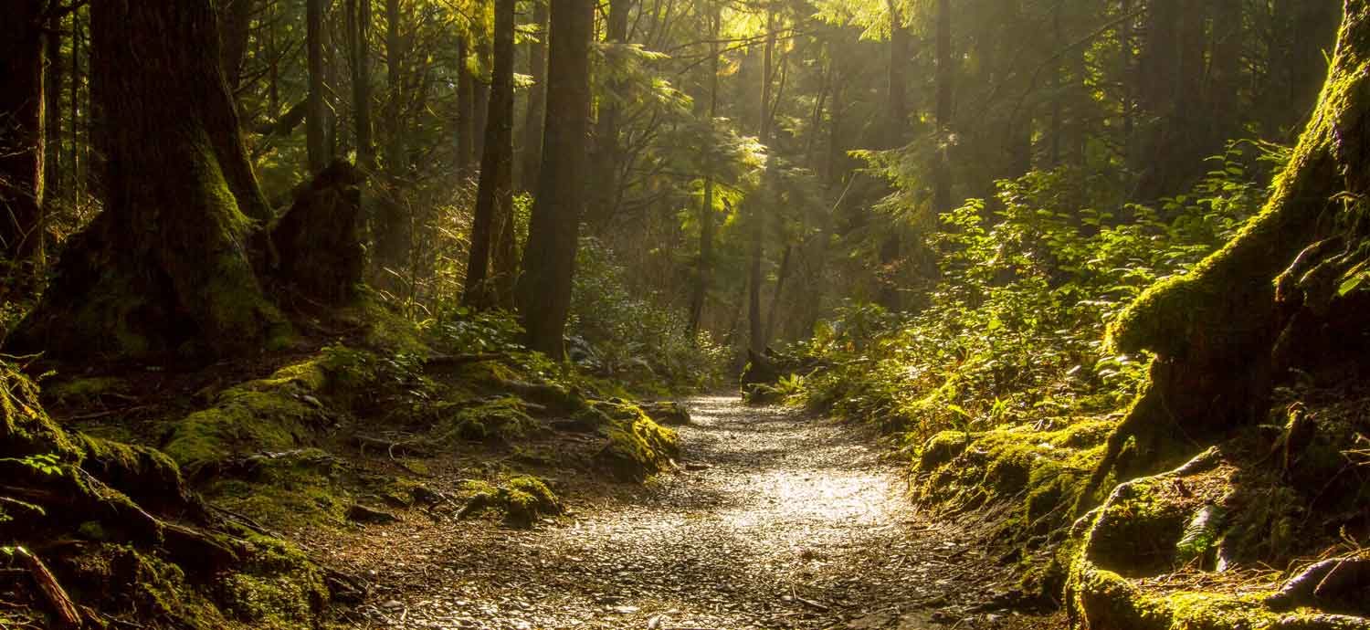
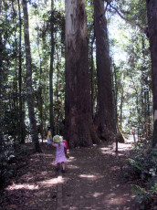
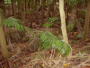
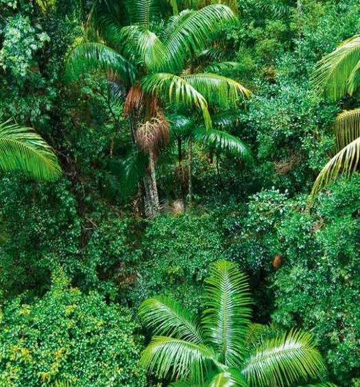
Lose yourself in the shade of white-washed flooded gums and rainforest gullies thick with piccabeen palms on a scenic mountain escape.
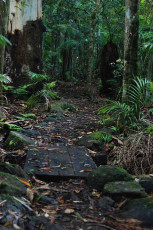
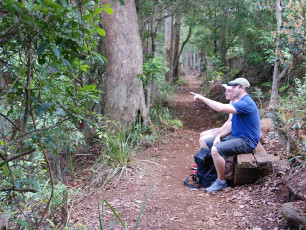
Walking tracks are provided in six sections of Tamborine National Park. Most walking tracks are short and can be walked within a few hours. The walks are relatively easy although some tracks have short, steep sections. If you are walking with young children, or if you are birdwatching or taking photographs, allow extra time.
Each walking track is classified according to a system based on Australian Standards (see below), so you can choose a track suitable for your capabilities and needs.
The classification system is based on Australian Standards. Please note that while each track is classified according to its most difficult section, other sections may be of an easier level.
Assisted wheelchair access.
Handrails at lookout.
Class 2 track (Australian Standards)
Easy level track, suitable for all fitness levels.
All junctions are signposted and may include interpretive signs.
Class 3 track (Australian Standards)
Gently sloping, well-defined track with slight inclines or few steps.
Caution needed on loose gravel surfaces and exposed natural lookouts.
Reasonable level of fitness and ankle-supporting footwear required.
Class 4 track (Australian Standards)
Distinct track usually with steep exposed inclines or many steps.
Caution needed on loose gravel surfaces and exposed natural lookouts.
Moderate level of fitness and ankle-supporting footwear required.
Walking tracks at a glance
Matching experience and expectations — to make your planning easier, simply match your expectations and experience with the most suitable track or circuit, using the tables below…
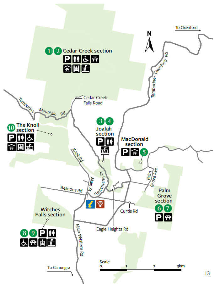
Map below showing numbered Walks (described in the table directly below). Click the map for a larger version.
Access to this section is prohibited at night in the interests of safety—see opening hours for more information. Signs have also been erected on-site to inform visitors of the closure details. It is important to note that the park closure is enforceable under the provisions of the Nature Conservation Act 1992 and penalties may apply.
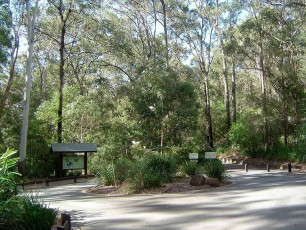
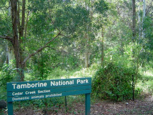
Access to this section is via Cedar Creek Falls Road. Near the start of the track are two large picnic areas surrounded by tall eucalypt forest. There is no access for large buses and motorhomes at Cedar Creek.

Time: Allow about 15min walking time.
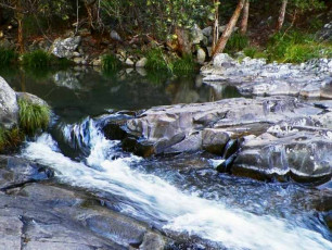
Details: Take a walk to Cedar Creek Falls lookout and admire views of the gorge, waterfalls and rock pools. The track to the lookout is suitable for stollers and assisted wheelchair access. For your safety, please observe the restricted access area signs (PDF, 87K) onsite and remain within the fenced walking track as access is not permitted to the area immediately above the waterfall and sections of the gorge, including some of the rock pools — penalties apply.

Time: Allow about 30min walking time.
Details: From Cedar Creek Falls lookout, descend through eucalypt forest and dry rainforest to the rock pools below. This section from the lookout to the rock pools is not suitable for strollers or wheelchairs.For your safety, please observe the restricted access area signs (PDF, 87K) onsite and remain within the fenced walking track. Access is not permitted to the area immediately above the top waterfall and sections of the gorge, including some of the rock pools—penalties apply.If you are swimming in the permitted rock pools, please be aware that there are many hazards in natural waterways—serious injury or death can result from diving or jumping into pools.Please be aware taking glass containers into the gorge and rock pool area is prohibited — penalties apply.


![Kookaburra on a sign - By Ron Korrel (Own work) [CC BY-SA 4.0 (https://creativecommons.org/licenses/by-sa/4.0)], via Wikimedia Commons](https://experiencetamborinemountain.com.au/wp-content/plugins/justified-image-grid/timthumb.php?src=https%3A%2F%2Fexperiencetamborinemountain.com.au%2Fwp-content%2Fuploads%2F2018%2F01%2F800-Kookaburra-in-Tamborine-National-Park.jpg&h=230&q=90&f=.jpg)
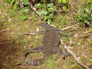
![A Lace monitor - By Alexandre Goloskok (Own work) [CC BY-SA 4.0 (https://creativecommons.org/licenses/by-sa/4.0)], via Wikimedia Commons](https://experiencetamborinemountain.com.au/wp-content/plugins/justified-image-grid/timthumb.php?src=https%3A%2F%2Fexperiencetamborinemountain.com.au%2Fwp-content%2Fuploads%2F2018%2F01%2F800-Lace-Monitor-in-Tamborine-National-Park-Cedar-Creek-Falls.jpg&h=230&q=90&f=.jpg)
![A Lace Monitor - By Alexandre Goloskok (Own work) [CC BY-SA 4.0 (https://creativecommons.org/licenses/by-sa/4.0)], via Wikimedia Commons](https://experiencetamborinemountain.com.au/wp-content/plugins/justified-image-grid/timthumb.php?src=https%3A%2F%2Fexperiencetamborinemountain.com.au%2Fwp-content%2Fuploads%2F2018%2F01%2F800-Lace-Monitor-in-Tamborine-National-Park-Cedar-Creek-Falls2.jpg&h=230&q=90&f=.jpg)
Palm Grove section (2 x Walks, click on TABS below)
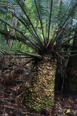
Palm Grove is named after the piccabeen palm Archontophoenix cunninghamiana that grows abundantly in this section. The main access point to this section is from Palm Grove Avenue. Parking for buses and caravans is not available. A picnic table is available at this site.

Time: Allow about 1 hour walking time.
Details: Explore the lush and diverse subtropical rainforest on this relatively easy walk.Discover peaceful piccabeen palm groves, rainforest with emergent strangler figs, distinctively-buttressed yellow carabeens and fascinating fungi along the way.

Time: Allow about 1.5 hours walking time.
Details: Incorporating the Palm Grove circuit, the Jenyns circuit leads out into drier eucalyptus forest.Here hoop pines, brush box and grey gums abound and you will visit a grove of ancient cycads.Please remain on the track as there are steep cliff edges. Supervise children carefully.

Joalah section (3 x Walks, click on TABS below)
Joalah is located at the headwaters of Cedar Creek and is accessible from both Eagle Heights Road and Dapsang Drive car park. A toilet block and large vehicle parking is provided at the car park. There are no picnic facilities at this site.

Time: Allow about 10 minutes walking time.
Details: A short walk through the rainforest on the outer edge of Joalah leads to several cafes and shops.
(Class 3)

Time: Allow about 30 minutes walking time.
Details: This enchanting walk begins in wet eucalypt forest beneath towering flooded gums. Notice a drop in temperature as the wet eucalypt forest merges into lush rainforest. Beautiful crows nest and staghorn ferns can be seen in the canopy above. The rock pool and surrounding basalt rock face provide important glow-worm habitat. Access to the Curtis Falls rock pool and surrounding area is not permitted. This is for the safety of visitors and the protection of glow-worm and platypus populations. Observe the restricted access area notice (PDF, 108K)

Time: Allow about 1 hour walking time.
Details: Branching off the Curtis Falls track, the Lower creek circuit crosses Cedar Creek before passing a giant, fallen strangler fig. Beyond the strangler fig the track is a class 4 walking track, with uneven surfaces, creek crossings that involve rock hopping and natural hazards likely to be present. Notice basalt boulders and columns on this creek-side rainforest walk.

The Knoll section (1 x Walk, see below)
Access to this section is via Knoll Road. The parking area is small and not suitable for large vehicles. There are spectacular views to Flinders Peak and Brisbane from the northern edge of the picnic area.

Time: Allow about 1 hour walking time.
Details: This walk features lush rainforest with towering trees emerging through the canopy. A 100 m track branches off through open eucalypt forest to Cameron Falls lookout. On a clear day enjoy views across the valley to Mount Flinders and southern suburbs of Brisbane. This track travels close to steep cliff edges. Please remain on the designated track, stay behind fences and supervise children at all times.

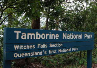
Witches Falls section (2 x Walks, click on TABS below)
Witches Falls is Queensland’s first national park, declared in 1908. Access is via Main Western Road. Parking is suitable for larger vehicles at the southern end of the picnic area.

Time: Allow about 1 hour walking time.
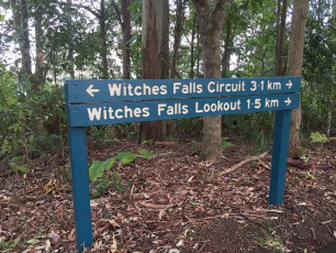
Details: Witches Falls circuit starts just beyond the commemorative shelter. The track zigzags down the mountain side pass a signed landslip area that requires walkers not to stop on this section of track, through an open forest of banksia trees and into rainforest with giant strangler figs. This circuit passes seasonal lagoons surrounded by piccabeen palm groves before reaching Witches Falls. After heavy rain the lagoons fill with water and spring to life with a variety of insect and frog species. Do not walk circuit in wet weather. Witches Falls lookout can still be accessed during wet conditions via the northern half of the circuit. The waterfall only flows after recent rain and is best viewed from the lookout platform, accessed via a 200m detour from the main circuit.

Time: Allow 1 – 2 hours walking time.
Details: Branching off the Witches Falls circuit, this track leads to Witches Chase off Beacon Road, passing Witches Falls lookout and on through rainforest with large red cedar trees and eucalypt forest.Return along the same track to re-join the Witches Falls circuit.

MacDonald section (1 x Walk, see below)
This precious tract of subtropical rainforest was named after Miss Jessie MacDonald, who generously donated part of this area to become a national park in 1933. The car park is on Wongawallen Road, off Tamborine–Oxenford Road. There are no barbecues or toilets at this site.


Tamborine National Park features
The Witches Falls section of the park was declared in 1908, making it Queensland’s first national park. Over the years additional reserves have been declared and today the park is made up of 14 sections of land on the Tamborine plateau and surrounding foothills.
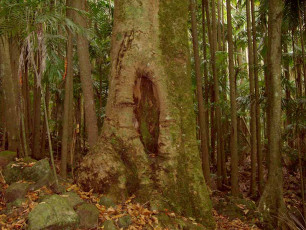
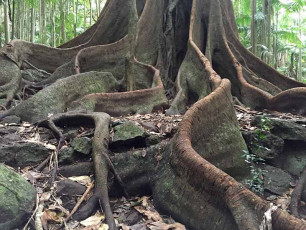
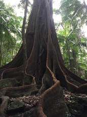
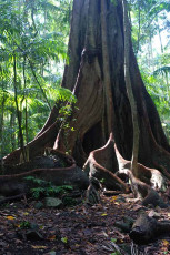
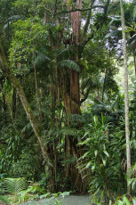
The park protects remnants of Tamborine Mountain’s plant communities and includes areas of rainforest with distinctive piccabeen palm groves, wet eucalypt forest dominated by tall flooded gums, open forest with bracken fern understorey and woodland. These plant communities provide essential wildlife habitat in a landscape almost entirely surrounded by urban and rural development.
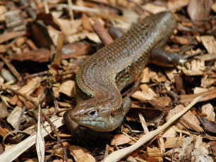
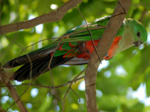
Tamborine Mountain escarpment hosts 85 percent of all animal species and 65 percent of all plant species found in the Gold Coast City area. Some common animals seen in the national park include Australian brush-turkeys, scrubwrens, pademelons and one of the world’s largest skinks, the land mullet. Catch a glimpse of the near threatened Albert’s lyrebird or hear it mimicking calls of other birds, particularly during the winter months. The Richmond birdwing butterfly and one of the rainforest’s most colourful birds, the noisy pitta, migrate seasonally to the park from nearby higher
altitude rainforests.
Basalt columns, cliffs, rocky outcrops and waterfalls are a lasting legacy of volcanic eruptions 23 million years ago. Tamborine is the most northerly remnant of the flows from a volcano centred on Mount Warning (Wollumbin).
Bushwalking
Every day, hundreds of people flock to Queensland’s national parks and protected areas to enjoy the pleasure of a bush picnic, seeing native birds and animals in the wild, or to simply just relax.
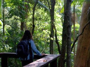
If you’re looking for a close encounter with nature, why not try bushwalking? Walking tracks can take you to places you won’t reach in a car and most are graded to make walking easy.
Take a walk and get close to delicate ferns beside the track, look up through leafy branches to towering tree tops, catch a glimpse of a yellow robin flitting among overhanging branches or gaze in wonder at picture-perfect views. Connecting with nature will leave you feeling refreshed and invigorated.
Before setting out, choose your park and track carefully. Plan to walk early morning to avoid the heat of the day or mid-week to avoid crowds. Pick a walk that suits your time and fitness level – from a short walk with a stroller or a well graded walk for wheelchairs to longer hikes that need higher levels of stamina.
Remember to always walk safely and walk softly.
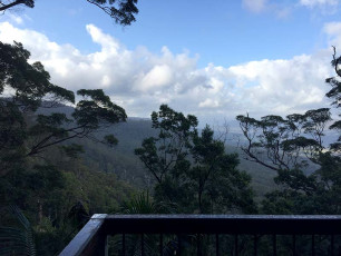
Within an hour’s drive of Brisbane and the Gold Coast, Tamborine National Park offers glimpses of the Pacific Ocean and Gold Coast skyline to the east and national parks of the Scenic Rim to the west.
You may be lucky and catch a glimpse of the elusive Albert’s lyrebird or luckier still and hear it sing.
While walking off that breakfast or lunch you can explore the cool rainforests on Tamborine Mountain in the Tamborine National Park.
Did you know that Tamborine National Park protects areas of rainforest that otherwise could be developed and spoiled?
Must dos
Witness Cameron Falls tumbling over the cliff top on the Sandy Creek circuit.
Trace the footsteps of folklore on a walk at Witches Falls — local children once believed this forest was haunted by witches and giants.
Go for a scenic drive stopping for a relaxing picnic with a view at The Knoll or Palm Grove.
Walk through ethereal rainforest and silvery eucalypt woodland, the fresh air revitalising your every step. Red-necked pademelons bound between slender palm trunks and towering buttress roots, while platypus and frogs dip into cool lagoons.
Admire sweeping views of Mount Warning, Mount Barney and Lamington National Park and the sparkling Pacific Ocean.
Did you know?
The place name ‘Tamborine’ comes from the local Yugambeh language. It means wild lime and refers to the finger lime trees that grow wild on the mountain and were eaten by the traditional Aboriginal people of this land.
Things to do
Wildlife spotting
Listen for strange gurgling sounds beneath your feet—these may be giant Tamborine earthworms travelling through waterlogged underground burrows. Let Richmond birdwing butterflies and colourful noisy pittas beguile you in summer.
Picnicking
Enjoy popular picnic areas in Cedar Creek, Palm Grove, The Knoll, Witches Falls and MacDonald sections.
Horseriding
Ride your horse on designated trails in some sections of the park. Access is from Beaudesert–Beenleigh Road or Tamborine Mountain Road. Visit npsr.qld.gov.au/experiences/horse-trails/ for information about the SEQ horse riding trail network.
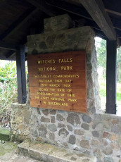
Queensland’s first national park
During an overseas trip in 1878, local pastoralist Robert Martin Collins was inspired by accounts of Yellowstone National Park, the world’s first national park established in the United States of America in 1872. When Collins returned to Australia, he began campaigning for the creation of national parks in Queensland to preserve the majestic mountain forests of the McPherson Range south of his home.
In 1896 Collins was elected to the Queensland Parliament where his campaign continued. Unfortunately, he was fighting for an ideal that in Queensland was without precedent, but not without opposition. Although some were sympathetic to the new ideal, many others thought the concept of environmental conservation was dangerous. However, Collins and others persisted and in 1906 State Government finally passed the State Forests and National Parks Act.
Around this time Tamborine Shire Councillors, Sydney Curtis and Joseph Delpratt, had become alarmed at the amount of clearing taking place on Tamborine Mountain. On 15 June 1907, Council recommended that 154 ha of the mountain be set aside…
‘… as a national park for the preservation of the flora and fauna as owing to the way the land in the vicinity is being cleared it would seem that in the near future such an action would prove its necessity.’
The Director of Forests agreed, recommending that this area be protected under The State Forest and National Parks Act of 1906 as a national park in October 1907.
Witches Falls was declared a national park in the Government Gazette on 28 March 1908, becoming the first national park in Queensland — 30 years after Collins first heard of the concept in the United States.
Geology
Tamborine Mountain’s ancient uprising is the result of eruptions from a huge shield volcano in the Mount Warning area of northern New South Wales about 20 to 23 million years ago. Eruptions smothered the surrounding landscape with layers of basalt lava flows. By the time the eruptions had ceased, this Tweed Volcano had risen to a height of 2km and a diameter of about 100km, forming a vast dome stretching south to Lismore, west to Mount Lindsay and north to Tamborine Mountain.
Twenty million years ago, after the volcano became extinct, water took over as the primary force shaping the landscape. Rain fell, forming streams that radiated off the dome, like the spokes in a wheel. Over time the streams became deeper and broader, gradually eroding the dome, forming valleys and gorges. Where streams approached each other, sections of the dome became isolated, forming ‘land islands’ or plateaus like Tamborine Mountain.
You Might Also Like


Visit Us on Social